
Mastering Fleet Efficiency with Precision Mapping
In the fast-evolving world of logistics, precision mapping has become the cornerstone of efficient fleet routing, transforming how businesses deliver goods

In the fast-evolving world of logistics, precision mapping has become the cornerstone of efficient fleet routing, transforming how businesses deliver goods

Precision mapping has emerged as a game-changing technology that revolutionizes how businesses operate, optimize resources, and achieve unprecedented levels of efficiency

Navigating modern cities demands precision, but dense urban environments pose significant challenges to Global Navigation Satellite Systems (GNSS), impacting everything from

Spatial alignment has become the cornerstone of immersive experiences, transforming how we interact with digital content in augmented and virtual reality
Positioning technology has transformed how we navigate the world, blending satellite systems, sensors, and algorithms to deliver unprecedented accuracy in location-based

Location accuracy isn’t constant throughout the day. Environmental factors, satellite positions, and atmospheric conditions shift dramatically, affecting how precisely your device

GPS technology has evolved far beyond basic navigation, offering centimeter-level accuracy for professional applications. Understanding the differences between RTK, PPP, and

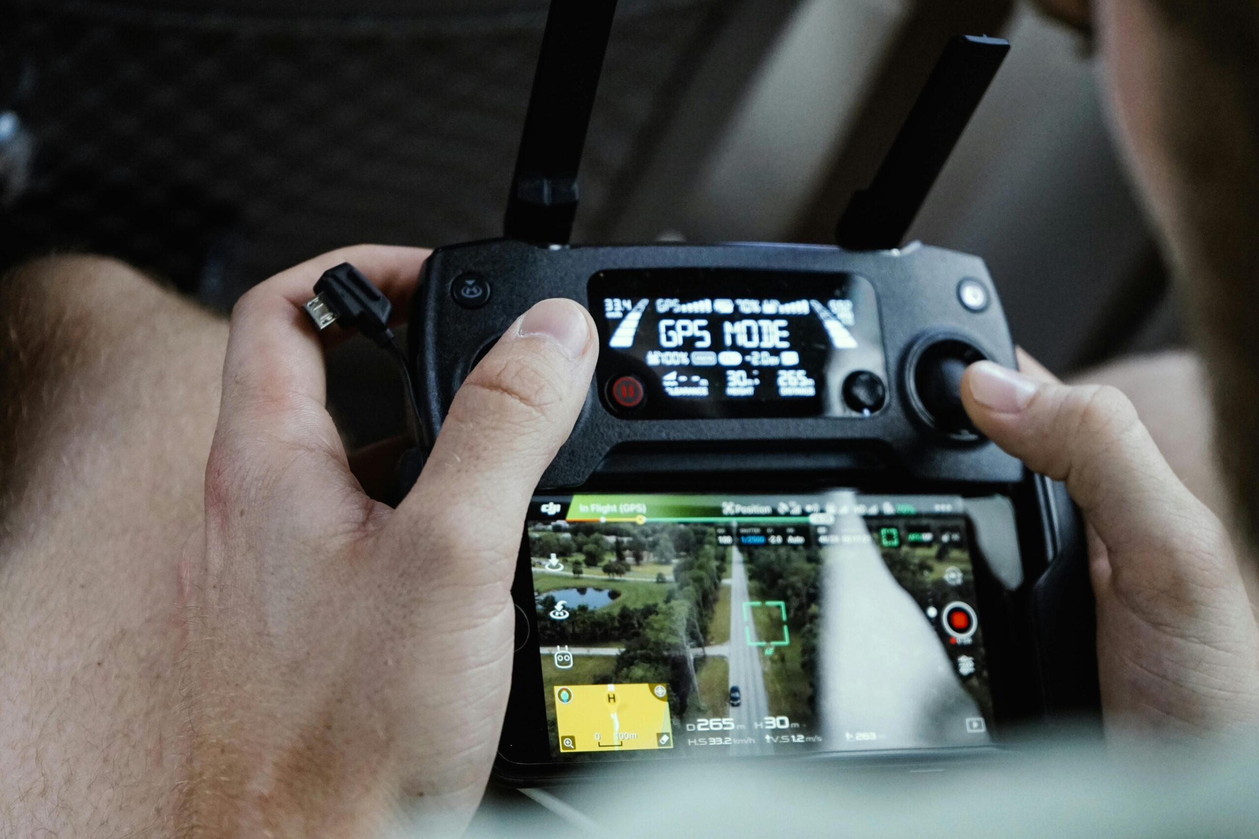
Drone corridor planning is revolutionizing industries from logistics to infrastructure inspection, but success depends entirely on precision mapping strategies that maximize
Global Navigation Satellite Systems have revolutionized positioning technology, but achieving true precision requires understanding and overcoming atmospheric interference, particularly weather-related phenomena

Modern positioning systems face three critical adversaries: multipath interference, signal drift, and occlusion errors that can severely compromise accuracy and reliability