Positioning technology has transformed how we navigate the world, blending satellite systems, sensors, and algorithms to deliver unprecedented accuracy in location-based services.
🌍 The Foundation of Modern Positioning Systems
At the heart of contemporary navigation lies a complex network of technologies working in harmony. Global Navigation Satellite Systems (GNSS), including GPS, GLONASS, Galileo, and BeiDou, form the backbone of positioning technology. These constellations orbit our planet, constantly broadcasting signals that devices use to calculate precise locations through trilateration.
The accuracy of positioning technology depends on multiple factors, from signal quality to atmospheric conditions. Understanding these variables becomes crucial for anyone relying on location-based applications, whether for personal navigation, professional surveying, or industrial automation. The journey from basic location awareness to centimeter-level precision represents decades of technological advancement and continuous refinement.
Modern positioning systems integrate multiple data sources beyond satellite signals. Inertial measurement units, magnetometers, barometers, and even visual positioning systems contribute to creating a comprehensive understanding of an object’s location and movement through space.
📡 Decoding Accuracy Metrics in Positioning Technology
Accuracy in positioning technology isn’t a single number but a spectrum of measurements depending on conditions and applications. Horizontal accuracy typically receives the most attention, measuring how closely a device can determine its position on Earth’s surface. Vertical accuracy, measuring altitude precision, presents additional challenges due to geometric satellite positioning and atmospheric effects.
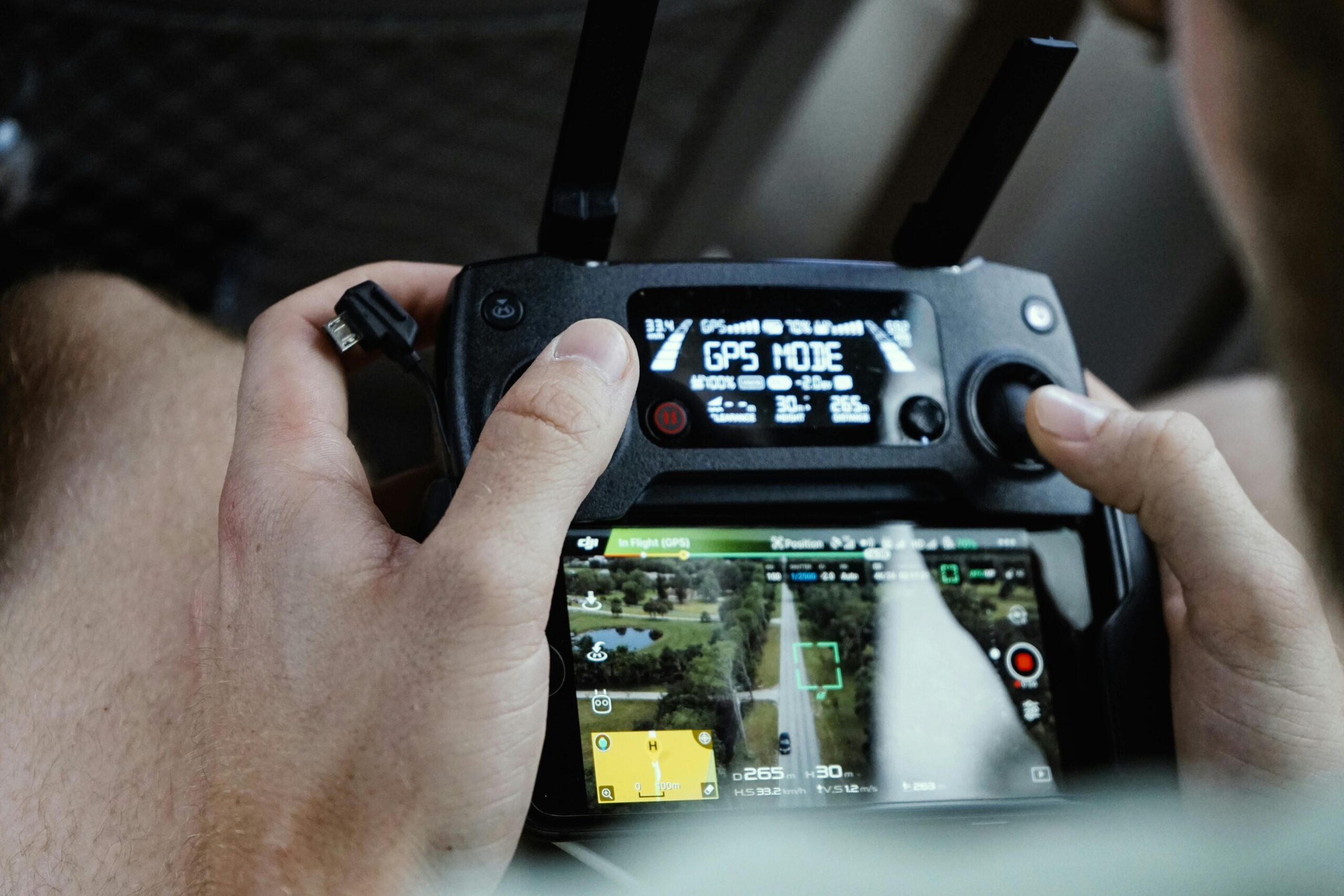
Standard GPS systems typically achieve accuracy between 5 to 10 meters under open sky conditions. However, this baseline performance varies significantly based on environmental factors. Urban canyons created by tall buildings, dense forest canopies, and indoor environments can degrade accuracy or completely block signals.
Advanced techniques like Differential GPS (DGPS) and Real-Time Kinematic (RTK) positioning push accuracy boundaries into the centimeter range. These methods employ reference stations with known positions to calculate correction data, transmitted to mobile receivers for enhanced precision. Such technology has revolutionized industries requiring exceptional accuracy, from precision agriculture to autonomous vehicle development.
Understanding Precision Versus Accuracy
A critical distinction exists between precision and accuracy in positioning technology. Precision refers to the repeatability of measurements—how closely multiple readings cluster together. Accuracy measures how close those readings are to the true position. A system can be highly precise but inaccurate if it consistently reports positions offset from reality.
Quality positioning solutions balance both characteristics. High precision with poor accuracy indicates systematic errors that calibration might correct. Low precision regardless of accuracy suggests random noise or instability requiring filtering or sensor fusion techniques.
🔧 Technological Innovations Enhancing Reliability
Reliability in positioning technology extends beyond accuracy to encompass availability, continuity, and integrity. A reliable positioning system consistently delivers accurate data when needed, maintains performance during transitions, and alerts users when accuracy degrades below acceptable thresholds.
Multi-constellation GNSS receivers represent a significant leap in reliability. By accessing satellites from multiple systems simultaneously, these devices increase visible satellite counts, improve geometric diversity, and maintain positioning capability when individual systems experience issues. This redundancy proves invaluable in challenging environments where satellite visibility is limited.
Sensor fusion algorithms combine GNSS data with inertial sensors, creating hybrid systems that maintain accuracy during brief signal losses. When a vehicle enters a tunnel or a pedestrian walks through a building, inertial navigation systems bridge gaps using accelerometers and gyroscopes to track relative movement from the last known position.
Augmentation Systems: The Accuracy Multipliers
Satellite-Based Augmentation Systems (SBAS) like WAAS, EGNOS, and MSAS provide free accuracy improvements by broadcasting correction data via geostationary satellites. These systems enable sub-meter accuracy across wide geographic regions, supporting aviation safety and precision applications without requiring local infrastructure.
Ground-Based Augmentation Systems (GBAS) deliver even higher accuracy for specific locations, commonly used at airports for precision approach and landing operations. The principle involves local reference stations calculating correction data for nearby users, achieving accuracy levels that support critical safety applications.
📱 Consumer Applications and Practical Implications
For everyday users, positioning technology accuracy directly impacts navigation reliability, fitness tracking precision, and location-based service quality. Smartphone GNSS receivers have evolved remarkably, incorporating dual-frequency capabilities and multi-constellation support that were once exclusive to professional equipment.
Navigation applications leverage positioning technology to provide turn-by-turn directions, but accuracy limitations occasionally cause confusion. When position estimates jump between parallel streets or lag behind actual movement, users experience the practical consequences of accuracy limitations. Modern applications implement map-matching algorithms that align GPS positions with known road networks, compensating for accuracy variations.
Fitness tracking applications depend on positioning accuracy to calculate distances, speeds, and routes. Athletes training for specific distance goals need reliable measurements, while casual users appreciate detailed activity maps. The difference between 5-meter and 2-meter accuracy becomes meaningful when calculating running distances or cycling routes.
Location-Based Services and Privacy Considerations
As positioning accuracy improves, privacy implications intensify. Centimeter-level accuracy enables precise tracking that raises legitimate concerns about surveillance and data security. Balancing the benefits of accurate positioning with privacy protection requires technical solutions like differential privacy and user control over location data sharing.
Applications requesting location access should clearly communicate why they need positioning data and how accurately. Users benefit from understanding that navigation apps require precise, continuous positioning, while weather apps might only need approximate location determined occasionally.
🏗️ Professional and Industrial Applications
Professional surveying demands accuracy that consumer devices cannot provide. Survey-grade GNSS receivers achieving millimeter-level precision enable construction layout, property boundary determination, and infrastructure monitoring. These systems integrate sophisticated error modeling, atmospheric correction, and extended observation sessions to achieve exceptional accuracy.
Precision agriculture relies on positioning technology to optimize resource application. Tractors equipped with RTK-GPS systems follow planned paths with centimeter accuracy, reducing overlap and gaps when planting, fertilizing, or spraying. This precision translates directly into cost savings and environmental benefits through reduced chemical usage.
Autonomous vehicles represent perhaps the most demanding application for positioning technology. Self-driving systems require not just accurate positioning but also integrity monitoring that instantly detects accuracy degradation. Multi-sensor fusion combining GNSS, LiDAR, radar, and cameras creates redundant positioning capabilities essential for safety-critical operations.
Mining, Construction, and Heavy Equipment
Heavy equipment automation in mining and construction revolutionizes these industries through precise positioning. Excavators, dozers, and graders equipped with GNSS receivers and automated control systems work to digital designs with minimal human intervention, increasing efficiency and safety while reducing material waste.
Machine control systems provide operators real-time guidance, displaying exactly where the blade or bucket is relative to the design surface. This technology reduces the need for stakes and grade checking, accelerating project completion while improving quality.
🛰️ Emerging Technologies Shaping the Future
Next-generation GNSS signals offer improved accuracy and interference resistance. Modernized GPS satellites broadcast L5 signals designed for safety-of-life applications, while Galileo’s E5 signals provide wider bandwidth supporting precise ranging. These signals enable better performance in challenging environments and faster ambiguity resolution in RTK systems.
Low Earth Orbit (LEO) satellite constellations promise to complement traditional GNSS with additional positioning signals. Companies developing global communication satellite networks explore positioning capabilities that could provide faster convergence times and improved urban performance due to different satellite geometries.
Visual positioning systems using cameras to recognize landmarks and environments offer GNSS-independent positioning for indoor spaces and urban canyons. These systems match observed features against databases of known locations, achieving accuracy comparable to or exceeding GNSS in appropriate conditions.
Quantum Positioning Technologies
Quantum sensors represent a frontier in positioning technology, promising navigation without external signals. Quantum accelerometers and gyroscopes measure motion with unprecedented precision, enabling long-duration inertial navigation without drift. While currently laboratory-scale technology, miniaturization efforts could eventually bring quantum positioning to practical applications.
Ultra-precise timing from optical atomic clocks could enhance GNSS accuracy by providing better time synchronization. Since positioning calculations fundamentally measure signal travel time, improved timing precision directly translates to better position accuracy.
⚠️ Challenges and Limitations to Consider
Despite impressive capabilities, positioning technology faces inherent limitations. Signal propagation through the ionosphere and troposphere introduces delays that vary with atmospheric conditions. Multipath effects, where signals reflect off buildings or terrain before reaching receivers, create ranging errors that sophisticated algorithms struggle to completely eliminate.
Intentional interference and spoofing present security challenges. GNSS signals are relatively weak when they reach Earth’s surface, making them vulnerable to jamming by stronger local transmitters. Sophisticated spoofing attacks can broadcast false signals that deceive receivers about their true position, raising concerns for applications requiring trusted positioning.
Power consumption constraints affect mobile device positioning performance. Continuous high-accuracy positioning drains batteries quickly, forcing trade-offs between accuracy and battery life. Smartphone operating systems implement various strategies to balance these requirements, from adjusting update rates to transitioning between positioning methods based on application needs.
Standardization and Interoperability
As positioning technology proliferates, standardization ensures interoperability between systems and applications. Organizations like the International GNSS Service establish standards for data formats, correction messages, and performance metrics. These standards enable positioning receivers from different manufacturers to utilize correction services and augmentation systems uniformly.
Open-source software and data sharing initiatives democratize access to advanced positioning techniques. Projects providing free GNSS analysis software and correction data enable researchers, developers, and small organizations to implement sophisticated positioning solutions without prohibitive costs.
🎯 Optimizing Positioning Performance in Practice
Achieving optimal positioning performance requires understanding both technology capabilities and environmental factors. Device placement significantly affects accuracy—GNSS antennas need clear views of the sky, with minimal obstructions blocking satellite signals. Metal objects and electronic interference sources should be kept away from GNSS receivers to prevent signal degradation.
Regular calibration and maintenance ensure positioning equipment operates at peak performance. Professional-grade receivers require periodic calibration of integrated sensors and verification of antenna phase center offsets. Even consumer devices benefit from occasional compass calibration and software updates that improve positioning algorithms.
Understanding uncertainty estimates helps users make informed decisions based on positioning data. Quality indicators like Horizontal Dilution of Precision (HDOP) and estimated position error provide insight into current accuracy. Applications should display these confidence metrics, allowing users to judge whether positioning quality suits their immediate needs.
🌟 Making Informed Technology Choices
Selecting appropriate positioning technology requires matching capabilities to application requirements. Consumer applications generally function well with smartphone GNSS receivers, offering 3-5 meter accuracy sufficient for navigation and general location awareness. Professional applications demanding higher accuracy justify investing in specialized equipment with external antennas and correction service subscriptions.
Cost-benefit analysis should consider total ownership costs beyond initial purchase prices. Professional GNSS receivers may require correction service subscriptions, periodic calibration, and specialized training. However, the improved productivity and quality they enable often justifies these investments for appropriate applications.
Future-proofing technology choices means selecting systems supporting emerging signals and technologies. Multi-constellation, multi-frequency receivers provide better performance today while remaining compatible with future GNSS modernization efforts. Modular systems allowing hardware and software upgrades extend useful equipment lifespans.
🚀 The Convergence of Positioning and Connectivity
Modern positioning increasingly integrates with connectivity, creating opportunities for enhanced performance through cloud-based processing and collaborative positioning. Network RTK services deliver correction data via internet connections, eliminating the need for users to maintain reference stations. These services democratize access to centimeter-level accuracy previously requiring significant infrastructure investments.
Crowdsourced positioning data helps improve maps and navigation services. When millions of users contribute position traces, patterns emerge that reveal road conditions, traffic flows, and map errors. This collective intelligence continuously refines the foundation upon which positioning applications depend.
The Internet of Things multiplies positioning applications as sensors, vehicles, and devices report their locations. Asset tracking, fleet management, and logistics optimization all rely on accurate, reliable positioning at scale. Managing this positioning data efficiently requires sophisticated database systems and analytical tools that extract actionable insights from location streams.
Mastering positioning technology means understanding its capabilities, limitations, and appropriate applications. As accuracy improves and reliability increases, positioning becomes invisibly integrated into daily life—from navigation aids to augmented reality experiences. The future promises even greater precision, enabling applications we’re only beginning to imagine, all built on the foundation of satellites orbiting overhead and the sophisticated receivers interpreting their signals.